
Japan's 1987 Government Survey Ranked Tundulu Alongside Kangankunde
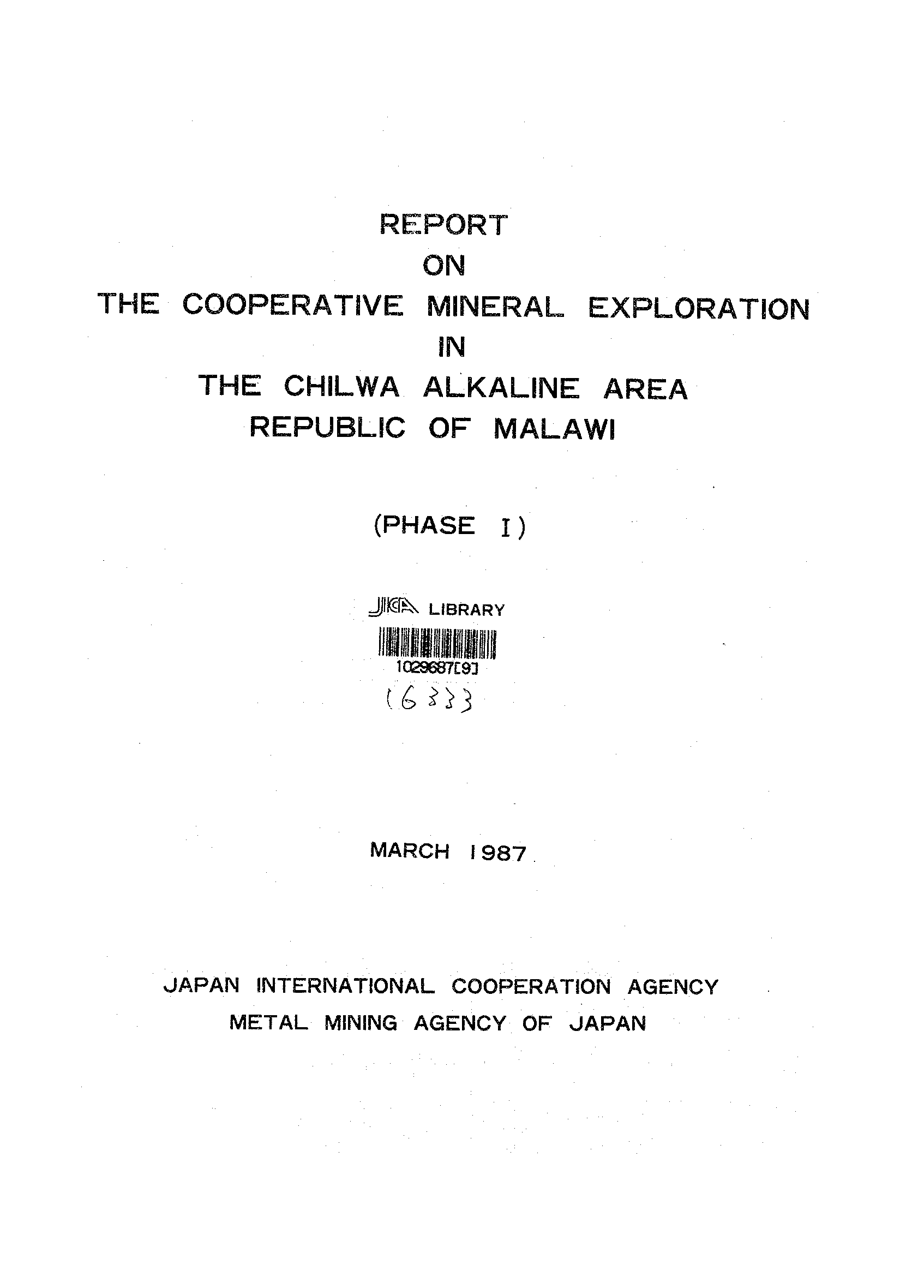
Between 1986 and 1988, the Japan International Cooperation Agency (JICA) and the Metal Mining Agency of Japan (MMAJ) ran a three-phase mineral exploration programme across southern Malawi's Chilwa Alkaline Province: 30,000 km² of ground, 25 target sectors, roughly 1,000 geochemical samples analysed for 60 elements, and, in the final phases, drilling of the best targets.
That programme examined the same ground that now hosts Lindian Resources' Kangankunde Project and Mkango Resources' Songwe Hill Project. Its conclusions about AuKing's Tundulu Project, reached decades before any of today's owners held the ground, make striking reading.
1. Only four of 25 sectors made the top tier, and Tundulu was named first
After combining geology and geochemistry, the Phase 1 survey placed just four sectors in its highest category, those “having high potentiality of the carbonatite deposit”: Tundulu, Songwe, Chilwa Island and Kangankunde. Tundulu was also one of only four sectors where massive, large-scale carbonatite was confirmed at all.

2. On geochemistry, Tundulu outranked Kangankunde
Fifteen elements were selected as carbonatite pathfinders (Ce, Dy, Eu, La, Lu, Nd, Nb, P, Sm, Sr, Tb, Th, U, Yb, Y). Only three sectors returned anomalous values, including strong anomalies, in every one of the fifteen: Tundulu, Songwe and Chilwa Island. Kangankunde was classed a tier below, among sectors anomalous in some, but not all, elements.

3. Tundulu's strongest anomalies were the heavy rare earths, while Kangankunde's were the lights
The detail is even more telling than the ranking. Tundulu's strong anomalies were dysprosium (Dy), terbium (Tb), yttrium (Y) and niobium (Nb): three high-value heavy rare earths plus a critical mineral in its own right. Kangankunde's strong anomalies were cerium, lanthanum, strontium and uranium, the classic light-rare-earth signature that defines its monazite orebody today. The heavy-leaning character AuKing sees at Tundulu was measured by an independent government survey in 1987.

4. Scale: the survey benchmarked Tundulu and Kangankunde against each other
Each sector chapter independently described the other as its peer. The Tundulu chapter assessed its carbonatites as being as large as those at Chilwa Island and Kangankunde; the Kangankunde chapter, in turn, described its carbonatite as one of the large deposits alongside Tundulu. In 1987, these were regarded as equivalent-class carbonatite systems.


5. Phase 1's recommendation: drill Tundulu
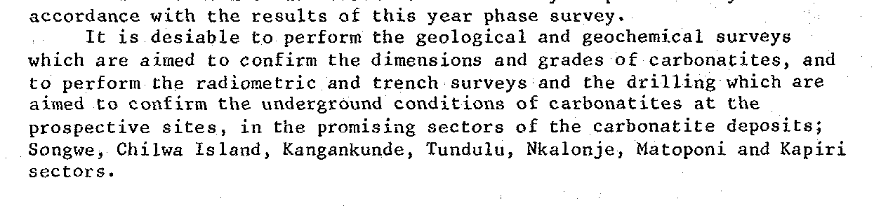
The Phase 1 report's closing recommendation was explicit: geological, geochemical, radiometric and trench surveys plus drilling to confirm the dimensions, grades and underground conditions of the carbonatites at the promising sectors, Tundulu among them.
6. JICA then drilled it, and reported grades in Bayan Obo's league
In the second and third phases (1987–88), the programme drilled three of its four top sectors: Songwe, Tundulu and Chilwa Island. Kangankunde was the exception; it was never drilled by JICA.
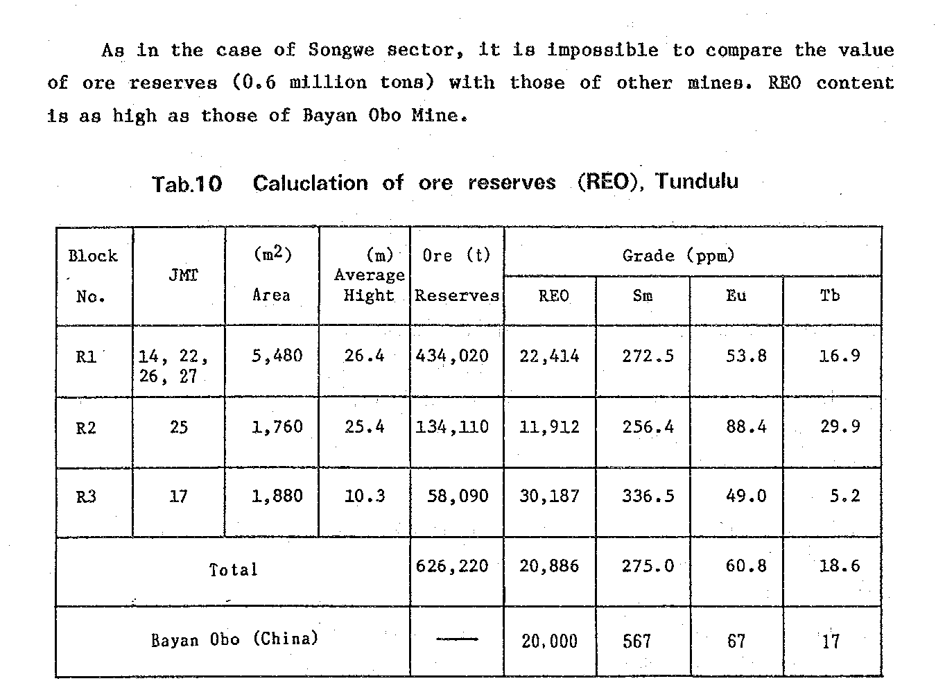
At Tundulu, drilling on the eastern slope of Nathace Hill defined rare earth and phosphorus mineralised zones, and the 1989 consolidated report published a preliminary estimate: about 0.6 million tonnes at 2.09% REO across three ore bodies, one of which graded above 3% REO. The report's own words: the REO content is as high as that of Bayan Obo, the Chinese deposit that remains the world's largest rare earth mine.
The tonnage is small by design, and the report says so itself. The estimate covered a single slope of one hill and assumed mineralisation extends just 50 m below surface, and counted only outcropping zones above a 1% REO cutoff; the report cautions that on those assumptions the figure cannot be compared with real mines.
The proof of how conservative the method was sits one valley over: Songwe's equivalent 1988 estimate was 1.4 million tonnes at 1.74% REO, and Mkango's modern drilling has since converted that same hill into 21 million tonne M+I resource. Tundulu, which JICA graded higher than Songwe, has never had a modern resource estimate published; the 2014–15 phosphate-focused drilling repeatedly ended in mineralisation, and AuKing's 10,000-metre programme is the first systematic, REE-targeted test of the system at depth.
7. A phosphate co-product graded above Brazil's Araxá
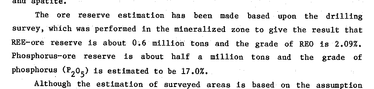
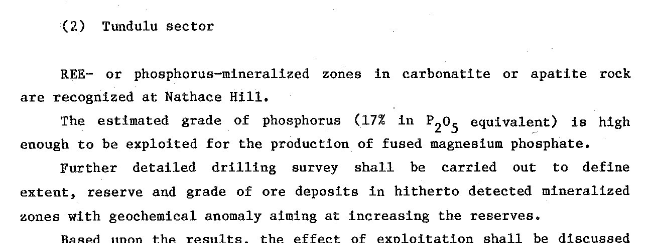
The drilling also defined a separate phosphorus estimate of about half a million tonnes at 17.0% P₂O₅, which the report benchmarks above the Araxá Mine in Brazil (15.01% P₂O₅), one of the world's great carbonatite operations, and describes as having high potential to be exploited. The programme's final recommendation for Tundulu was to carry out further detailed drilling to define the extent, reserve and grade of the mineralised zones, aiming at increasing the reserves. That is, almost word for word, the programme AuKing is executing now.

How the JICA programme saw today's three projects
| JICA / MMAJ programme, 1986–88 | Tundulu (now AuKing, ASX: AKN) | Kangankunde (now Lindian, ASX: LIN) | Songwe (now Mkango, AIM: MKA) |
|---|---|---|---|
| Overall evaluation | High potentiality (top tier of 25; listed first) | High potentiality (top tier of 25) | High potentiality (top tier of 25) |
| Carbonatite scale | Massive / large-scale; peer of Kangankunde | Massive / large-scale; peer of Tundulu | Massive / large-scale (two ring dykes mapped) |
| Geochemical coverage | Anomalous in all 15 pathfinder elements | Anomalous in some elements only (second tier) | Anomalous in all 15 pathfinder elements |
| Strong-anomaly elements | Dy, Tb, Y (heavy REE) + Nb | Ce, La (light REE) + Sr, U | Dy, Eu, Sm, Tb, Yb, Y + Th, U |
| JICA drilling, 1987–88 | Drilled; preliminary estimate 0.6 Mt at 2.09% REO (one hillside, 50 m depth cap) plus 0.5 Mt at 17% P₂O₅ | Not drilled | Drilled; preliminary estimate 1.4 Mt at 1.74% REO (50 m depth cap) |
| Status today | Maiden 10,000 m REE drill programme under way | 261 Mt resource; construction/production stage | Definitive feasibility completed; 21 Mt M+I |
Rows one to five paraphrase the 1987 and 1989 JICA/MMAJ reports; the final row reflects publicly disclosed project status as at July 2026 and does not derive from those reports.
The pattern is hard to miss. The programme's preliminary numbers wildly understated Songwe, whose 1.4 Mt keyhole estimate became an 21 Mt modern resource. Kangankunde, which JICA could not drill at all, became a 261 Mt resource. Tundulu, the sector the programme listed first, graded higher than Songwe and equated with Bayan Obo, is the one whose modern drilling chapter is being written right now.
Sources: JICA & MMAJ (1987), Report on the Cooperative Mineral Exploration in the Chilwa Alkaline Area, Republic of Malawi (Phase 1), and JICA & MMAJ (1989), Consolidated Report. Both are publicly available from the Japanese Government's official JICA report repository: Phase 1 Part 1 (PDF) and Part 2 (PDF); Consolidated Report (PDF), openjicareport.jica.go.jp. Excerpt images are unaltered scans of the reports reproduced for reference.